Tag Archives: path

Thanks Rails to Trails

Last year I joined Rails to Trails because I ride regularly on the Little Miami Bike Path which is a rails to trails transformation.

Rails to Trails Bike Path

The people at Rails to Trails are creating a nationwide network of trails from former rail lines and connecting corridors of people and places. It’s a wonderful project. Their vision is that 90 percent of Americans will live within three miles of a trail system by 2020.

Rail-trails are multi-purpose public paths created from former railroad corridors. They are most often flat or follow a gentle grade as they traverse urban, suburban and rural communities in America. Ideal for many uses, such as walking, bicycling, inline skating, cross-country skiing, and equestrian and wheelchair use, rail-trails are extremely popular for both transportation and recreation. – Source: Rails to Trails

Rails to trails exists in a large way from Railbanking. There are more than 350 rail corridors (43 states plus D.C.) have been railbanked, with more than 160 trails open partially or fully on railbanked corridors. Railbanking is a voluntary agreement between a railroad company and a trail agency, which enables the agency to use an out-of-service rail corridor as a trail until a railroad might need the corridor again for rail service.

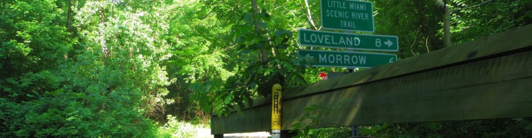
Thanks to Railbanking and Rails to Trails many Americans have access to smooth, safe bike paths. My favorite is The Little Miami Scenic Trail in Ohio. It is 78 miles long paved with Asphalt and Concrete. One I’d like to try is Florida Keys Overseas Heritage Trail a 106.5-mile Florida Keys Overseas Heritage Trail (FKOHT) that stretchs the length of the Florida Keys, from Key Largo to Key West, (love Key west) the southernmost point of the continental United States.

Find out more: http://www.railstotrails.org/

Donate if you can, I did.

Leave a comment

Filed under bike, path

Bike “Hunting-Season” Safety Tip

Orange Headgear Good Idea During Hunting Season

Nerd Alert: You could buy a helmet cover like the one above here.

I wasn’t sure how to title this post, because the title I wanted to use was:

“How to Keep Your Head from Being Blown Off During Hunting Season”

but it was too long.

Gir Xar Orange Helmet

If you ride during hunting season, you want to wear orange to avoid being mistaken for a deer.

Especially if you ride off road. You can’t buy this New Giro XAR Orange Helmet until Feb 2011. and it will cost about $130. You might have to go with a helmet cover like the one above.

Orange Long Sleve Cycle Jersey

Next consider an orange jersey for cycling like this Capoforma from Cambria Bike.  Capoforma cycling apparel and casual clothing is one of the few treasures in cycling. American owned, Italian manufactured. Its the bright orange color you need during hunting season.

Wearing orange during hunting season is a wise idea, even if you are on a bike path like the Little Miami Valley Bike Path. You ride alongside a river, but you also ride through farmland and some wooded areas. And I hear guns going off all year long, not just during hunting season.

Hunting Season is here, stay safe, wear some orange.

Leave a comment

Filed under bike, path

Xenia Creekside Bike Path featured in World Watch Magazine

Recently, World Watch, a print and web publication featured this photo that I took in it’s magazine.

Xenia to Mad River Bike Path 104

Featured on page 9 of their article titled, “Power to the Pedals” which is about urban cycling and the benefit of decades of trial and error. The Creekside Bike path was cited as an ‘off-street’ bike path separated from automobile traffic and features two-way traffic. Read the full article here: World Watch: Power to the Pedals

This photo was from a set of photos I took when riding from Xenia Station west along the Mad River Bike path in Ohio. Here is a slide show of my ride from Xenia west alongside the Mad River on the Creekside trail.

The Creekside Bike Trail is featured in World Watch Magazine

Leave a comment

Filed under bike, path

Bike Paths on Google Maps

In the US only, Google Maps now has bike maps and suggest city routes for bikers. This is an excellent feature for finding bike routes and paths in any city.

One bad thing is you cannot embed the bike map. From Google’s site: Keep in mind that you won’t be able to embed Traffic maps, Mapplets, and some other Maps features.

Still, there is some good value here in finding new bike paths you didn’t know existed.

Leave a comment

Filed under bike, path

Winter Little Miami Bike Path


March 10th: the last of the snow was still on the Little Miami Bike Path about 2 to 3 miles south of Loveland. I tried to navigate in the snow but my skinny tires gave little traction on the slippery snow causing me to lose it on two separate occasions. Good thing I had my bike pants on with the padded hips. lol

See my complete Little Miami Valley Bike Path slide show and video.

2 Comments

Filed under bike, path

1.9 Miles of New Bike Path in Middletown, Ohio

The Middletown Bike path is part of the Great Miami Recreational Trails (GMRRT) which connects to trails in Montgomery and Miami Counties. Here is a section of the new bike path extension:
Ok, this video is incredibly boring, but it is a significant bike path event in Middletown, Ohio.

Middletown Mayor thanked everyone for coming and acknowledged the council members who were there including Vice  Mayor Jim Armuruster, Anita Scott Jones, Josh Laubach, and AJ smith. Mayor Mulligan said, “This section we are  dedicating today is Section 3,  1.9 miles long and begins at the current termination point, St. Rt. 4 and Carmody  boulevard.”  This section cost approximately $433,000.

Vice Mayor Jim Armbruster said, “Certain people I want to thank for making this possible of course is the Ohio  Department of Natural Resources, Middletown Community Foundation, Arthur Harvey Foundation and the Barnitz Fund,
Miami Conservatory District…”

The Middletown bike path now is 6.8 miles from Carmody (ST RT 4) to Trenton, St RT 73 just east of the Great Miami  River bridge.

The next 2.1 mile section going north will stop at the Franklin city limits. This future portion will be funded by Energy  efficiency and conservation block grant (EECBG) funds* in the amount of nearly $500,000.

3 Comments

Filed under bike, path

Dangerous Bike Path Intersection

View Dangerous Intersection Bike Path in a google map.

Just west of Caesar Creek Lake, the Little Miami Bike Path crosses Highway 47 is a bit dangerous, if you believe the sign. It’s not dangerous if you stop and look both ways. But if you are flying across intersections, the southbound traffic on the path can not see the southbound traffic on HW47 very easily.

1 Comment

Filed under bike, path

Video: Morrow to Oregonia Bike Path Trip

morrow to oregoniaWhat’s it like on the Little Miami Bike Path in SW Ohio? Here is the first of a series of videos will be doing for my blog, MyBikePath.com.

This 8.36 Mile stretch of the 76 mile Little Miami bike path is one of my favorites. Many updates on crossings and path conditions. Music courtesy of Pandora and BlackBerry.

Video updates distances, road crossing cautions and horse poop.

2 Comments

Filed under bike, path

Miamisburg to Dayton Bike Trip

Stewart Street bridge over the Great Miami River in Dayton, Ohio

Stewart Street bridge over the Great Miami River in Dayton, Ohio

I had a rude awakeinng on my bike trip today. The plan was to take Great Miami River Recreational Trail north from Friend Park (paved bike path) to downtown Dayton past St. Rt 35.  However the Bike Path Closed at Stewart Street for Bridge Construction in Dayton, Ohio.  This was the end of my bike trip north. Headed back south to Friend Park.

Friend Park to Stewart St MapFriend park is so small that it isn’t on any map I could find. It was the place to pickup from my last bike trip which started in Franklin Ohio, just south of the lion bridge.

This was a pretty good workout because the bike trip included several hills and for the most part was very scenic. The bike path is free from debris in very good condition in safe neighborhoods and areas.

Bounded by I-75 to the East and the Great Miami River to the west, this one plus mile of bike path subjects riders to exaust fumes from the highway.

Bounded by I-75 to the East and the Great Miami River to the west, this one plus mile of bike path subjects riders to exaust fumes from the highway.

There was a 1+ mile strip where the bike path is bounded by I-75 to the east and the Great Miami River to the west. The vapor from the cars on the trucks was heavy in the air during that stretch. Even so, it was interesting to ride along the road I ususally take when going to or from the Dayton Airport.

Wright Brothers Seaplane base was on this stretch of the Great Miami River

Wright Brothers Seaplane base was on this stretch of the Great Miami River

Here on the Great Miami River in 1913, Orville Wright made the first successful takeoff and landing from water. Performed the feat in at Wright Model C airplane fitted with the first airplane pontoons.

This area was chosen because of the 90 degree bend in the river. This allows take off and landing into the wind no matter what direction it is blowing.

I have created a Flicker Photo Set (24 photos) here:

Miamisburg to Dayton Bike Path

2 Comments

Filed under bike, path

Yellow Springs to Springfield Bike Path

This is my final leg of the 72 Mile Little Miami Bike Path in SW Ohio. I have rode every section and blogged about much of it.  The bike path runs from Buck Creek State Park near Springfield to Anderson Township (east of Cincinnati).

Since I hadnt been to Springfield yet, Im going right.

Since I hadn't been to Springfield yet, I'm going right.

The bike path has its roots in 1846 with “The Little Miami Railroad Company” which connected Cincinnati with Sandusky. In 1986 the Little Miami Bike Path was fully funded. The ‘Spirit of the Little Miami Railroad’ was resurrected in October 1991 with an official opening of one of the most important and historic connections, Xenia to Yellow Springs. (Source: Little Miami Scenic Trail).


Today’s leg is 14 miles round trip from Yellow Springs to I-70. At no point does the bike path on this leg come close to the Little Miami River. This is one of 2 legs that don’t travel alongside of the Little Miami. The other is Spring Valley to Xenia. The path generally follows the Little Miami River.

The Bike Path was in very good condition around Yellow Springs

The Bike Path was in very good condition around Yellow Springs

It was a beautiful Sunday morning around 9 am when I started on a trip that had the bike path in excellent condition. It was a real pleasure to ride this section of the Little Miami Bike Path.

Yellow Springs to Springfield, Morrow to Lebanon 154

The dog owners were very cooperative this morning. Keeping their pets on leashes and away from the bikes. I like to ride in the AM because there are fewer people using the bike path.

Beautiful bike path views for the entire ride!

Beautiful bike path views for the entire ride!

The only disappointment was the ending of this great adventure. Where does the path officially end? Shouldn’t there be some sort of marker? I passed a map station about a half mile ago, was that it?

Map Stop near Springfield

Map Stop near Springfield

Not much to look at. Bet I’m near the end.

This is the real end of the Bike Path in Springfield

This is the real end of the Bike Path in Springfield

I followed the sign to the corner of Leffel Ln and S Yellow Springs Street and ended up in the middle of a large intersection.

This is the End?

This is the End?

To sum up my 14 mile bike adventure from Yellow Springs to Springfield and back to Yellow Springs, I’d have to say the condition of the bike path made for a real enjoyable ride. But the ending was like a mystery.

Where is the real end of the Little Miami Valley Bike Path? Perhaps its not right to call this the end or the begining. This might just be another piece of a very large and wonderful bike path, if indeed it gets extended to Sandusky, just like the original railroad.

3 Comments

Filed under bike, path